
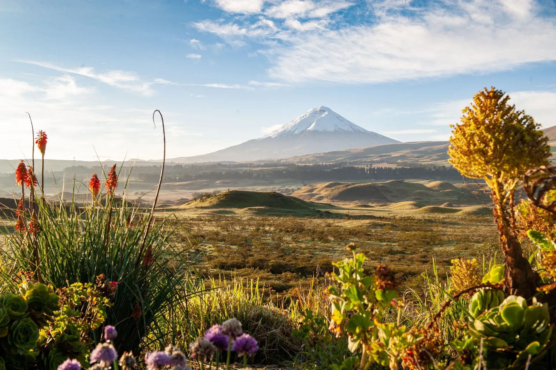
Cotopaxi dominates the central Ecuadorian Andes as a 5,897-meter active stratovolcano crowned by tropical glaciers. Located 50 kilometers south of Quito, its symmetrical cone draws climbers navigating crevasses and hikers exploring the high-altitude páramo.
Eighty-seven known eruptions shaped the 5,897-meter symmetrical cone of Cotopaxi. The active stratovolcano anchors a high-altitude national park 50 kilometers south of Quito in the central Ecuadorian Andes. Tropical glaciers cap the upper slopes, starting at 4,700 meters on the western flank and stretching to the crater rim. Below the ice, a vast páramo ecosystem covers the plains, dropping to 3,500 meters at the park entrance. Driving south from Quito along the Pan-American Highway takes about two hours, ending at the El Chasqui turnoff where local taxi-trucks wait to transport visitors inside.
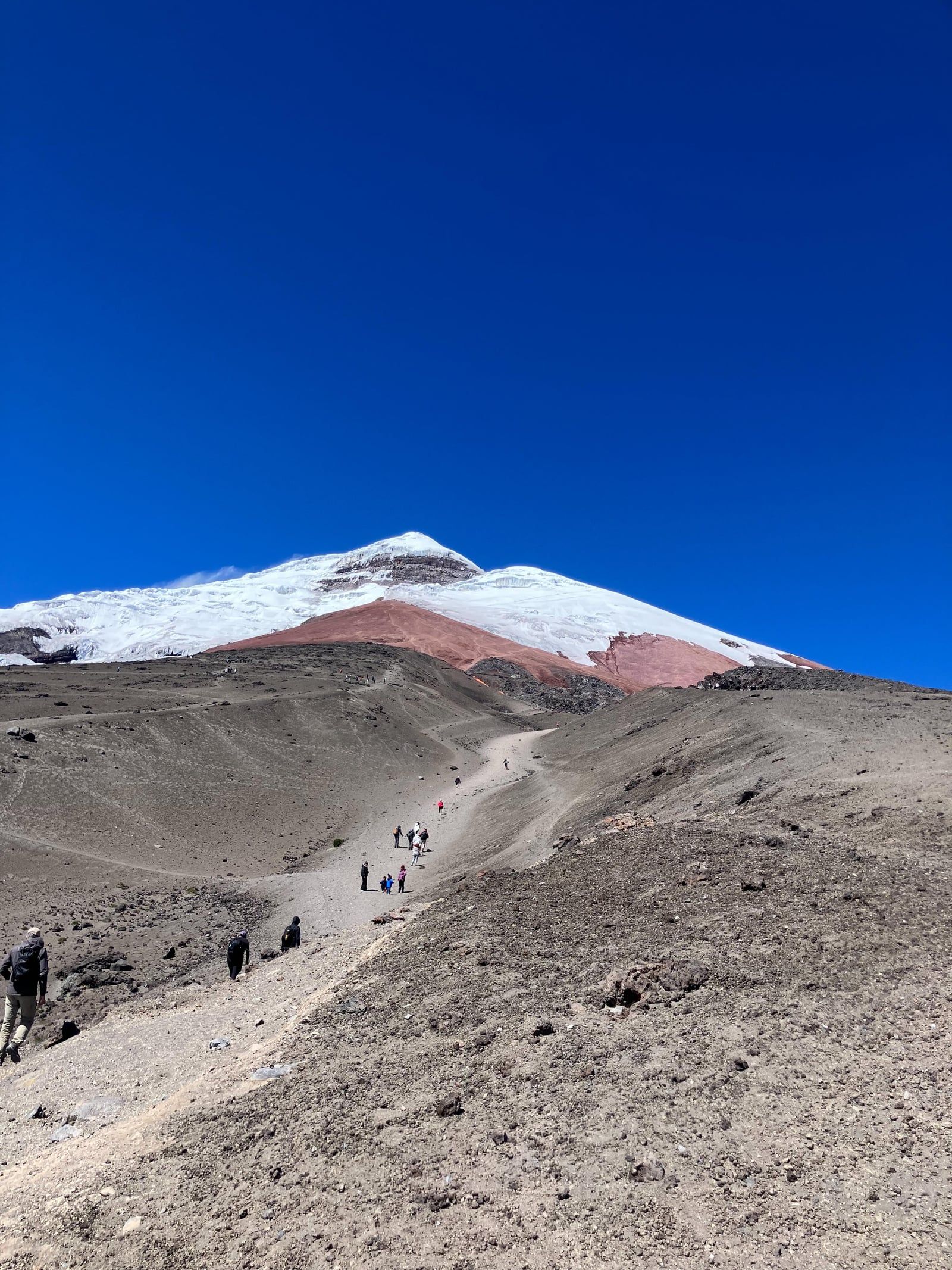
Wind whips across the volcanic scree at the José Ribas refuge parking lot. Visitors step out of vehicles at 4,500 meters into thin, freezing air. A 45-minute hike up the red dirt trail tests lung capacity, ending at the 4,800-meter hut where climbers prepare for midnight summit pushes. Hikers can continue another 45 minutes to touch the glacier's edge at 4,864 meters. Massive crevasses split the ice. The raw environment demands respect, and sudden snowstorms frequently force climbers to turn back. The rapid ascent from Quito often triggers acute mountain sickness, requiring visitors to walk slowly and drink plenty of water.
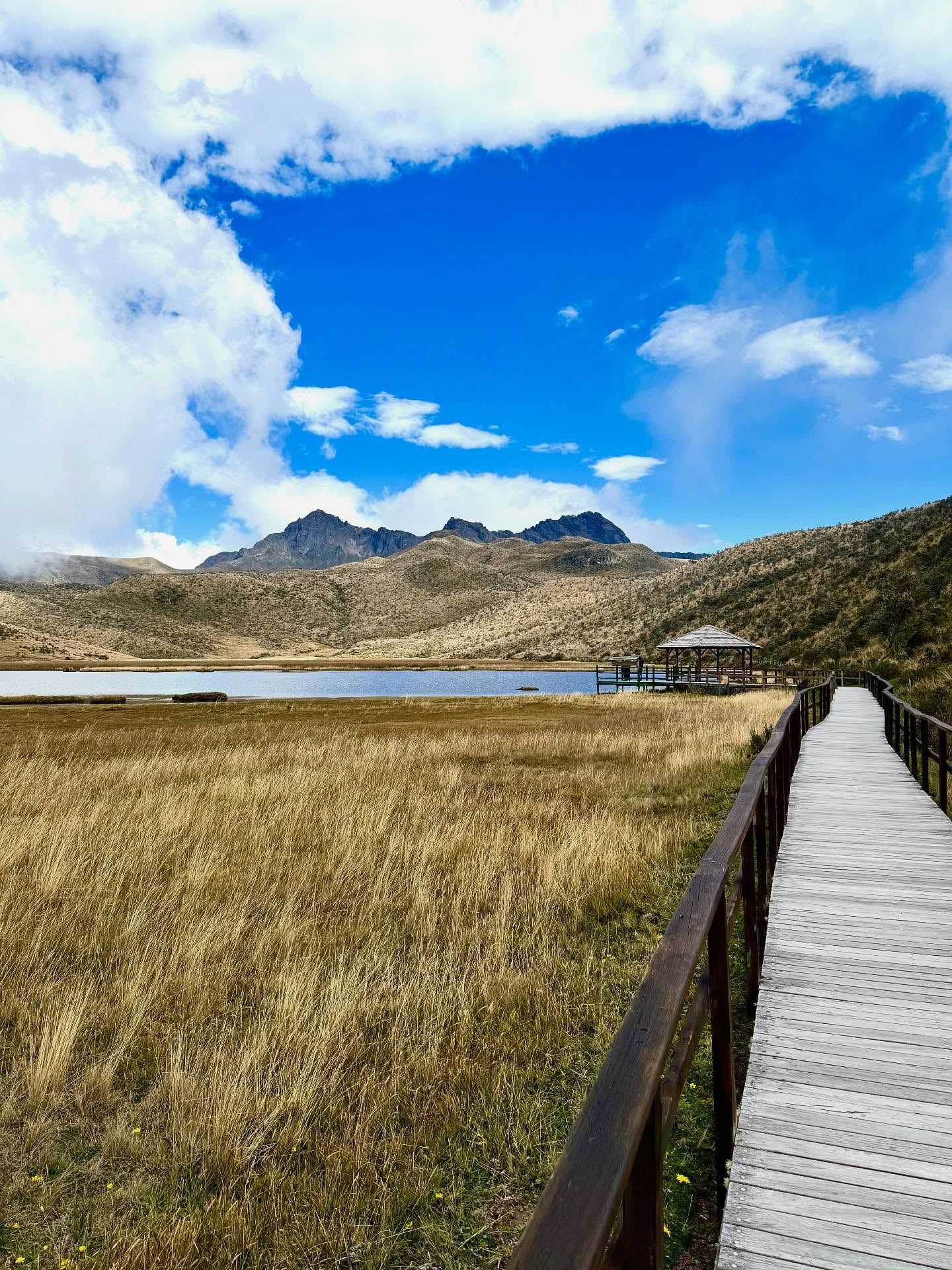
Lower down, the landscape flattens out around Limpiopungo Lagoon. A 2.2-mile loop trail circles the 3,800-meter wetland. Semi-wild horses graze on the paramo grass while Andean gulls circle overhead. The water reflects the volcano's peak on clear mornings. Clouds typically roll in by late morning, obscuring the mountain entirely. Visitors arriving after 10:00 a.m. often see nothing but gray fog. Park gates open at 8:00 a.m., and arriving early provides the only reliable window for visibility. High-altitude UV radiation remains intense even on cloudy days, making SPF 50+ sunscreen and polarized sunglasses mandatory.
Thrill-seekers rent mountain bikes for an intense descent from the refuge parking lot. The ride transitions rapidly from steep volcanic scree to rolling green pastures. Condors occasionally soar overhead as cyclists navigate the rugged terrain down to the park entrance. Families with older children often opt for horseback riding across the wind-swept grasslands. This allows visitors to cover more ground while spotting wild horses roaming freely across ancient lava fields. Older travelers or those struggling with the altitude should stick to the flat path around Limpiopungo Lagoon and take frequent rest breaks.
Pitching a tent at designated campsites near Limpiopungo or Santo Domingo at 3,600 meters offers a stark wilderness experience. Temperatures drop rapidly after sunset. Campers huddle around fires under ink-black skies, watching the snowcapped summit glow in the moonlight. The next morning, many visitors drive 15 minutes to the adjacent El Boliche National Recreation Area. This quieter zone features pine forests and gentle walking trails, providing an alternative ecosystem away from the main volcano crowds. Climbers seeking non-technical routes often head to Cerro Rumiñahui, an inactive volcano one hour from the trailhead, to acclimatize before attempting Cotopaxi.
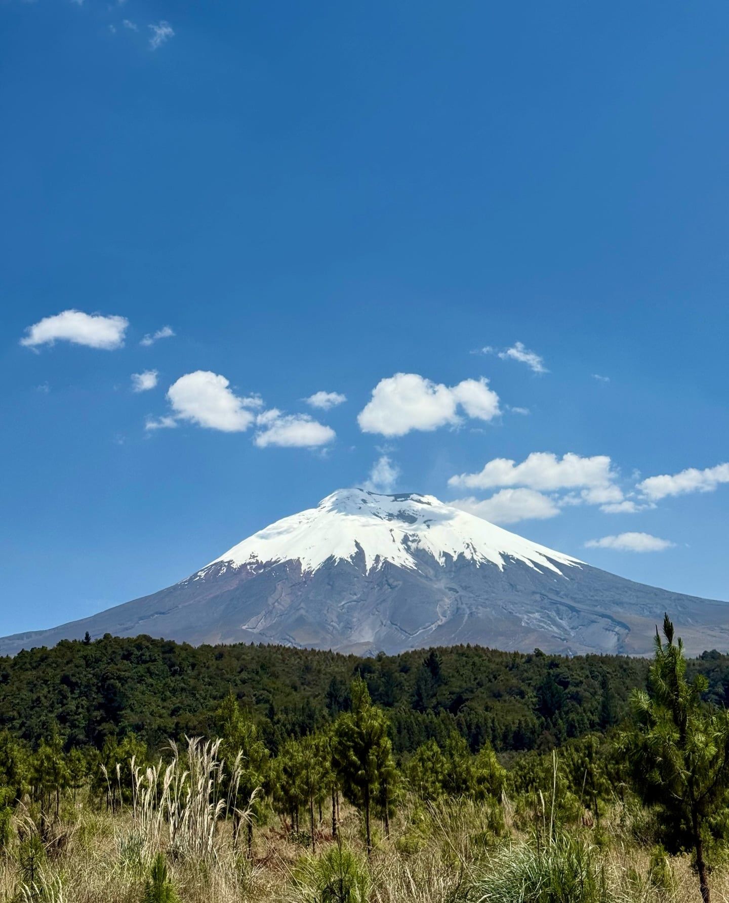
Violent geological forces built Cotopaxi over thousands of years. The stratovolcano's first recorded eruption occurred in 1534, coinciding with the Spanish arrival in the Andes. Ash choked the sky, and lava flows scarred the flanks. Indigenous populations and European colonizers alike watched the mountain reshape the surrounding valleys. The volcano established a pattern of destructive cycles, alternating between decades of quiet and sudden, catastrophic explosions. Eighty-seven known eruptions have occurred since that first recorded event, cementing its status as a highly active peak in South America.
Four massive eruptions defined the mountain's modern history. In 1742, 1744, and 1768, the volcano unleashed massive columns of ash and pyroclastic flows. The 1877 eruption proved the most destructive. Superheated volcanic material instantly melted the entire ice cap. Massive lahars—walls of mud, water, and debris—surged down the slopes. These mudflows traveled over 100 kilometers, reaching both the Pacific Ocean and the Amazon basin. The colonial town of Latacunga, sitting directly in the lahar's path, was completely leveled. Residents rebuilt the town, only to face subsequent destruction from later eruptions. Today, Latacunga stands as a working city 30 minutes south of the park, bearing the historical scars of its proximity to the crater.
Explorers began targeting the summit in the late 19th century. On November 28, 1872, geologists Wilhelm Reiss and Angel Escobar completed the first successful ascent. They navigated deep crevasses and fragile snow bridges to reach the crater rim. The volcano's last major eruptive period ended in 1904. Minor activity flared up in 1940, followed by a long period of dormancy. In 2015, the mountain woke up again. Ash emissions and seismic unrest forced the temporary closure of Cotopaxi National Park. Today, it ranks as the third-highest active volcano in the world. Scientists monitor the peak 24 hours a day due to its proximity to Quito and Latacunga. Automated warning sirens dot the national park. If the alarms sound continuously, visitors must immediately evacuate along designated routes.
Cotopaxi rises 5,897 meters above sea level with a prominence of 2,500 meters. The mountain forms an almost perfect symmetrical cone, a classic hallmark of a stratovolcano built by alternating layers of hardened lava, pumice, and volcanic ash. A minor secondary cone, known as Cabeza del Inca or "Inca's Head," interrupts the smooth eastern profile. This rocky outcrop provides a stark contrast to the otherwise uniform slopes. The base of the volcano spans roughly 22 kilometers in width, dominating the skyline of the surrounding Cotopaxi Province.
Tropical glaciers dominate the upper elevations. The permanent ice cap begins at 4,700 meters on the western flank and completely covers the summit. These glaciers contain massive, deep-blue crevasses that shift constantly under the immense weight of the ice. The freezing environment at the crater rim sits in sharp contrast to the equatorial latitude. At the top, the main crater spans roughly 800 meters in diameter, releasing continuous plumes of sulfurous steam from active fumaroles. Climbers reaching the summit at sunrise can look down into this active vent while taking in views of neighboring peaks like Antisana and Chimborazo.
Below the snowline, the terrain transitions into a barren landscape of red and black volcanic scree. This loose, rocky surface makes hiking difficult, as boots slide backward with every step. The lower slopes flatten out into the high-Andean páramo, a vast grassland ecosystem situated between 3,500 and 4,500 meters. Here, ancient lava fields lie hidden beneath tough paramo grass. The porous volcanic soil drains water rapidly, creating a harsh environment where only specialized plants survive. Visitors driving through the Control Sur gate pass directly through these jagged lava formations before reaching the park museum. The museum features ramps for wheelchair access and displays detailed cross-sections of the volcano's geological layers.
The high-Andean climate surrounding the volcano shifts violently within minutes. Hot sunshine can transition to freezing rain or sudden snowstorms without warning. The thin atmosphere at these elevations accelerates dehydration and increases the physical toll on the human body. At the 3,500-meter park entrance, the air contains significantly less oxygen than at sea level. By the time climbers reach the 4,800-meter refuge, every step requires conscious effort. The extreme environment dictates strict rules for visitors: multiple warm layers, windproof shells, and sturdy walking boots are mandatory for survival on the upper slopes.
Local Andean populations revered Cotopaxi long before the 15th-century Inca invasion. Indigenous mythology recognized the mountain as a sacred entity and a guarantor of land fertility. Farmers living in the surrounding valleys believed the volcano controlled the rain. They viewed the summit as the physical home of their gods. The mountain's frequent eruptions were interpreted as divine communication, demanding respect and offerings from the communities living in its shadow. The name Cotopaxi itself translates roughly to "Neck of the Moon" in local indigenous languages, reflecting its towering presence against the night sky.
The volcano's destructive power shaped the cultural identity of the region. The town of Latacunga, located directly south of the park, has been destroyed and rebuilt three times following catastrophic lahars. This cycle of devastation and reconstruction forged a resilient local culture. Today, Latacunga operates as a hub for traditional Andean markets and festivals that acknowledge the mountain's constant presence. The local chagra, or Andean cowboy, culture thrives in nearby towns like Machachi. These skilled horsemen still navigate the harsh páramo terrain, leading visitors across the wind-swept grasslands directly beneath the towering peak.
Modern Ecuadorians maintain a complex relationship with the volcano. It stands as a symbol of national pride and a major economic driver through tourism, yet it remains a constant physical threat. Schools in the surrounding valleys conduct regular evacuation drills. The integration of automated warning sirens into the daily landscape serves as a stark reminder of the mountain's dual role as both a natural wonder and a deadly force. To experience the traditional chagra lifestyle safely, travelers can hire a local guide for a horseback ride starting near the northern control booth.
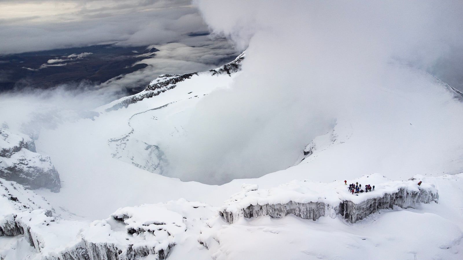
Reaching 5,897 meters, Cotopaxi ranks as the third-highest active volcano in the world.
Rare equatorial glaciers begin at 4,700 meters and completely cover the summit.
The 1877 eruption melted the ice cap, sending destructive lahars all the way to the Pacific Ocean.
A rocky outcrop on the eastern flank named Cabeza del Inca breaks the volcano's perfect symmetry.
Volcanic mudflows completely leveled the nearby colonial town of Latacunga three separate times.
The national park utilizes an automated siren system to warn visitors of imminent eruptions.
Andean gulls thrive at 3,800 meters around Limpiopungo Lagoon, far higher than typical seagull habitats.
Entry to the national park is free of charge. Visitors must present a valid passport or ID to register with a park ranger at the entrance gate.
The park gates open daily from 8:00 a.m. to 3:00 p.m. Visitors already inside can remain until 5:00 p.m. or 6:00 p.m.
The summit reaches an elevation of 5,897 meters (19,347 feet) above sea level. This elevation ranks it as the second-highest peak in Ecuador.
You can visit the park independently to hike around Limpiopungo Lagoon or drive the main roads. Climbing to the summit requires a certified local guide.
Yes, Cotopaxi is an active stratovolcano with 87 known eruptions. It experienced a period of unrest and minor ash emissions in 2015.
A lahar is a destructive mudflow composed of volcanic debris, mud, and water. They occur when volcanic heat rapidly melts a mountain's glacier.
Pets are strictly prohibited inside the park boundaries. This rule protects native wildlife like wild horses, deer, and Andean condors.
The José Ribas refuge sits at 4,800 meters (15,748 feet). Reaching it requires a steep 45-minute hike from the parking lot at 4,500 meters.
Take a bus from Quito's Quitumbe Terminal toward Latacunga and exit at the El Chasqui turnoff. From there, hire a local taxi-truck for $15 to $30 to enter the park.
Arrive at the park gates right when they open at 8:00 a.m. Heavy clouds and thick fog typically obscure the peak by late morning.
Browse verified tours with free cancellation and instant confirmation.
Find Tours